• PLEASE NOTE - the TEAS facebook page has been hacked, take extreme care when visiting the page, for further information visit here

COVID-19 My Coronavirus Mount Everest Climbing and Fundraising Challenge

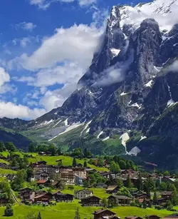
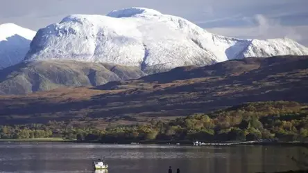
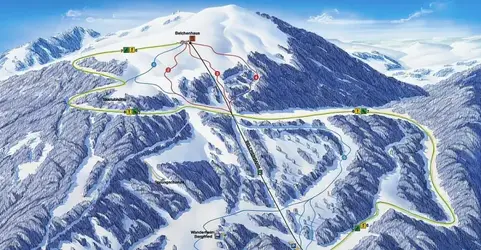
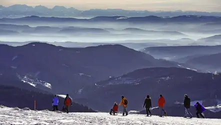
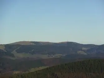
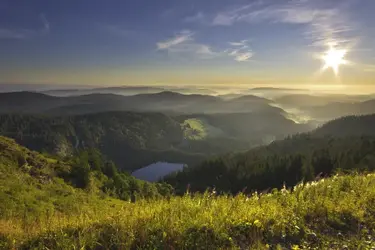
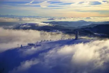
I had my lunchbreak at the top of the Belchen in the Black Forest; it is one of the highest peaks (1414 m).
1589728684879.png

If there is snow in winter, it doubles up as a local ski resort with an Alps view thrown in on clear days!
1589728751792.png 1589729042388.png

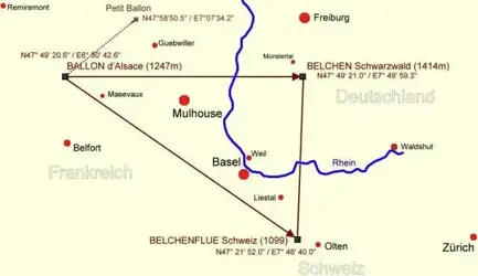
The Black Forest Belchen is part of a perfect natural Pythagorean triangle of mountains with the same Celtic name in solar alignment with the main Celtic settlement in the Rhine valley. There is another Belchen (now Ballon d'Alsace) straight West in the Vosges and a third one (now Bölchen) straight South in Swiss Jura.
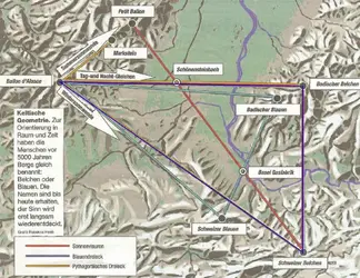
A similarly aligned smaller triangle with three minor peaks callen 'Blauen' in all three mountain ranges is doing for another nearby Celtic settlement that has been a major manufacturing and trading centre in the Basel area where the ware coming up the Rhone valley gets loaded onto boats going down the Rhine or vice versa.
1589729855764.png 1589729952549.png
 
Amazing scenery, I think once this pandemic is over we are going to have to visit this area, it looks so beautiful x

The Black Forest is excellent hiking country, and so are the Swiss Jura and the Vosges which are much less touristy if you want to stay off the beaten track. You've got some interesting cities in the upper Rhine Valley - Basel (Switzerland), Freiburg i. Breisgau (Germany) and Colmar (France), with Basel/Mulhouse airport just outside Basel and a tri-national local metro train service via Basel right up to Zell in the Black Forest and Mulhouse in France. And boat tours on the Rhine...
Snowfall can be somewhat iffy and unpredictable, especially with climate change, but you are more likely to get snow in February than in December. But I have done a fair deal of cross country skiing in the Black Forest.
I went to the Black Forest area 40 years ago on the back of a motorbike! Would love to see it at a slower pace and take more in x
 
well done to both of you.i love all the views,
I had my lunchbreak at the top of the Belchen in the Black Forest; it is one of the highest peaks (1414 m).
View attachment 142610

If there is snow in winter, it doubles up as a local ski resort with an Alps view thrown in on clear days!
View attachment 142611 View attachment 142613

The Black Forest Belchen is part of a perfect natural Pythagorean triangle of mountains with the same Celtic name in solar alignment with the main Celtic settlement in the Rhine valley. There is another Belchen (now Ballon d'Alsace) straight West in the Vosges and a third one (now Bölchen) straight South in Swiss Jura.
A similarly aligned smaller triangle with three minor peaks callen 'Blauen' in all three mountain ranges is doing for another nearby Celtic settlement that has been a major manufacturing and trading centre in the Basel area where the ware coming up the Rhone valley gets loaded onto boats going down the Rhine or vice versa.
View attachment 142616 View attachment 142617
Well done @Wiebke ! It looks glorious up there.
 
I am resting up on the summit of the highest Black Forest Mountain, the Feldberg (it translates as 'Field Mountain') at 1493 m tonight.

Admittedly it is not the most imposing of elevations (the Belchen is more impressive), but it is a busy resort, especially in winter, and where we as a family learned skiing with very outdated second-hand skis predating the Second World War. You had to tie in your shoes manually and everything was wood and leather! Of course in those years there was only a single lift up there once we graduated to it instead of trying to carve our two or three bends and then climb up the gentle slope again... Today, there is quite a bit more on offer!

1589747367569.png

The views from up there are great!
1589747484862.png

1589747546495.png

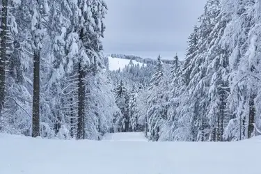
Some of my most magical memories are cross country skiing (which I took up as an adult and actually enjoy more) are stomping through a pine forest in the falling snow. Hardly anyone is out there. The fresh snow is great for climbing up uphill, but not for gliding down because it is very sticky and as not compacted down so it is more of an effort to get round. The falling snow is muffling any noise and it is as silent as you hardly ever experience.

1589748183787.png
You expect to meet Santa with his black clad servant Ruprecht and his donkey at any moment. Because - as we all knew where I grew up - Santa actually lives in the Back Forest, together with many of the characters in the Grimm fairy tales! :D
 
Tonight I am resting on the top of the Wildspitz, a distinctive peak of the first chain of Alpine mountains, overlooking lake Zug (where all the rich - not just Swiss bankers from nearby Zurich - have their homes or second homes because of the low tax rates...)

1589836546742.png

Yes, you get the whole Alps panorama yet again, just a lot closer than from the Black Forest; so I'd rather feature a look back across Lake Zug and the Swiss Midlands towards the chain of the Jura mountains on the horizon instead!
1589836672174.png
 
Tonight I have reached the Chasseral, the highest peak in the Swiss Jura (1607 m), located above Lake Neuchatel/Neuenburger See in the French speaking Western part of the country. The Jura makes great hiking country with splendid views over the various lakes at the foot of the mountain chain and towards the whole Alps chain.1589926687098.png

1589926707978.png

I could of course have equally chosen the Casseron just a little further along at 1601 m... It's a bit more craggy than the Chasseral.
I guess it is more a matter of personal preference...
1589926836524.png

1589926898173.png

This is wine growing country; you can see the vineyards running along the foot of the Jura chain, facing south and soaking up the sun. Swiss wine is generally more dry and mostly drunk in the country so it is generally not well known internationally.
 
I have zipped right across the country to the far Southeast of Switzerland not far from the border to Austria where I am putting up my imaginery tent in the Alping village of S-chanf at 1660 m. It lies in the Engadin Valley, which runs from West to East and forms the upper part of the Inn river, one of the tributaries of the Danube. The water that runs under this bridge will eventually end up in the Black Sea!

This is view westward
1590008728074.png

And this the view to the East. Austria starts roughly where you see the tall mountains.
1590009464370.png

S-chanf (pronounced S-tchanf) lies in the Romansh speaking part of the country and borders the Swiss National Park, where you can spot marmosets, capricorns or even - fo you are very lucky - one of the successfully reintroduced bearded vultures that were hunted to extinction in the 19th century because they are big enough to carry off a lamb. This picture is from one of the side valleys off S-chanf. The Engadin is popular with hikers but tourists tend to concentrate on St Moritz at the top of the valley.
1590008906827.png
 
The last two warm days have been very sapping for me; by the time it got a bit cooler in the house again, hub had already gone to bed; so no afternoon/evening session!

Nevertheless I have reached the top of the highest mountain of the Jura mountains at 1720 m, the Crêt de la Neige ('The Snow Crest') just outside the Swiss border on the French part of the Jura.
1590183075341.png

You can see why it has got its name!
1590183207199.png

On good days, you can see across Geneva and Lake Geneva to the Mont Blanc/Monte Rosa, the highest peak in the Alps on the French/Italian border at 4810 m.
1590183907693.png
Way to go yet to get up there, but I will hopefully reach that summit some time in summer!
Way yo go for me yet... but I will
 
The Rigi mountain at 1798 m is one of the first mountains of the Alps when you approach Lucerne. It is very scenic as it mostly surrounded by lakes - Lake Lucerne (on the left) on two sides and Lake Zug and little lake Lauerz (in the front) on the third.
1590270212751.png
It is also very civilised with a little train running straight up and down on two sides; it is the oldest gauge rack railway in Europe - old enough that Queen Victoria went on it when she spent several years of her widowhood retired from public duties on Lake Lucerne!
Conveniently, you take one of the ferry ships on Lake Lucerne just outside Lucerne railway station to the foot of the Rigi and get onto the train that takes you right to the top; have a look around, have your lunch or a cup of coffee in the restaurant at the top and then take next train down on the other side to another regular railway station in ArthGoldau to pick up the next train back to Lucerne!
This was the first tour I did with my future husband. My dad had offered him his own gloves and his red woolly bobble hat when he my parents for the first time, which hub wasn't sure whether it was a practical joke. So I took them in my rucksack. While it was balmy short sleaves spring weather down in the lowlands, the top of the Rigi was still covered in snow with a fresh breeze blowing drifts. Then the hat and gloves came in very handy! Although hub is most definitely NOT red bobble hat material! :D

Here is a link to a little video of the train going down from the top towards Lake Lucerne. Of course you can walk in either direction if you are terribly eager! It is as popular as Snowdon in summer... You also get some of the stunning 360 degree views!
 
Tonight I have passed the Maloja Pass (1815 m) at the upper end of the Engadin Valley; it is the watershed between the Danube (which drains into the Black Sea) and the mighty Po river in Northern Italy which hits the Adriatic near Venice.
But you don't have to climb out of the Engadin Valley; you basically fall over the edge into a steep gorge which is gradually nibbling away at the Engadin. The little river that is the source of the En/Inn river isn't far from the edge; in the not very far future (geologically speaking), it will end up running down into the Po!

1590356143667.png

If you love serpentines, then you are most definitely in heaven!

1590356229765.png

1590356280717.png
 
Tonight I have passed the Maloja Pass (1815 m) at the upper end of the Engadin Valley; it is the watershed between the Danube (which drains intoe the Black Sea) and the mighty Po river in Northern Italy. But you don't have to climb out of the Engadin Valley; you basically fall over the edge into a steep gorge which is gradually nibbling away at the Engadin. The little river that is the source of the En/Inn river isn't far from the edge; in the not very far future (geologically speaking), it will end up running down into the Po!

View attachment 143502

If you love serpentines, then you are most definitely in heaven!

View attachment 143503

View attachment 143504
Wow! You're making great progress @Wiebke.

I've reached Snowdon but have been feeling a bit low and been in pain so haven't had the motivation to do the stairs or even post from the top of Wales.

Tomorrow is due to be a lovely day, so I'll try and get back to my usual routine.

Thanks for being an inspiration! :)
 
Back
Top